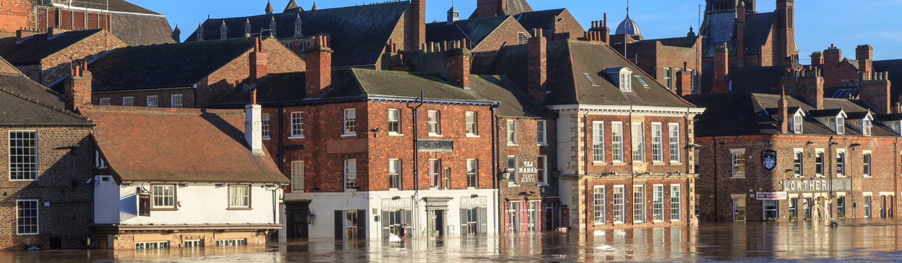
It might not be too much of a surprise that according to the Met Office, December 2015 has been provisionally assessed as the wettest month for the United Kingdom since records began in 1910. Most of the rains fell in Scotland, Northern Ireland, Wales and northern England, where many places have seen flooding. So far, southern England hasn't suffered any serious flooding this winter.
The series of storms to hit the UK this December were propelled by the jet stream, a current of strong winds that can reach up to 200mph. The jet stream travels between 9-16km above the planet's surface. The jet stream has carried a succession of storms eastward across the Atlantic to hit the UK in December 2015. The current El Niño event, coupled with climate change are thought to have made the storms worse than usual.
Last month was also the warmest December on record for the UK, with the mean temperature for the month at 7.9C, which is more like the mean temperature normally experienced across the UK in April or May. It is expected that the UK's unusually warm weather will soon be replaced by a colder, drier late winter, but exactly when the change will happen is still uncertain.
Meanwhile, the current El Niño event is now looking like it could become the strongest ever recorded. You can find out more about El Niño by downloading and reading the latest issue of Conservation Education. Written just before Christmas, it outlines the development of the 2015-16 El Niño event. Since then, there have been new El Niño-related impacts reported.
As a result of El Niño, food shortages in southern Africa resulting from the drought conditions are likely to peak in February 2016, while flooding is expected in parts of Central America. The worst floods in 50 years have already been seen in Paraguay, Argentina, Uruguay and parts of Brazil, while other parts of Brazil are seeing unusually low rainfall.
Higher than average temperatures have been noted in many parts of Europe and the US, with farmers forced to harvest salad, strawberries and asparagus much earlier than usual. But in northern Mexico, El Niño is being blamed for freezing temperatures, with snow seen in the Sonoran Desert for the first time in 33 years.
And at the top of the world, a weather buoy drifting in the floating sea ice just south of the North Pole has recorded temperatures of above freezing, which is amazing, as the seasonal average for the time of year is minus 25C. This spike in temperature is not likely to last long, but will inevitably slow the growth of winter ice in the Arctic.
Photo by Allan Harris shows the floodwaters in York, taken 27 December 2015.